

Curriculum 2011
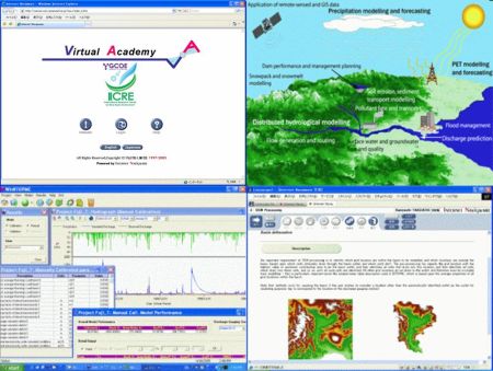
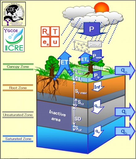
Basic River Basin Hydrological Simulation
Advanced River Basin Hydrological Simulation
Landslide hazard zonation using GIS techniques (New from 2011) *
* We, all Virtual Academy project, will express our appreciation to Dr. Silva G.H.A.C. University of Ruhuna, Sri Lanka
* Mainly E-Learning Course will be offered (Web Based Training Course).
Curriculum in detail
Basic River Basin Hydrological Simulation
- Lesson 1. Overview of Hydrological Models
- Lesson 2. What's YHyM/BTOPMC?
- Lesson 3. Digital Elevation Model (DEM)
- Lesson 4. Precipitation & Discharge Data
- Lesson 5. Soil & Land Cover
- Lesson 6. Potential Evapotranspiration
- Lesson 7. YHyM/BTOPMC Parameterization and Application
Advanced River Basin Hydrological Simulation
- Lesson 1. Overview of Hydrological Models
- Lesson 2. What's YHyM/BTOPMC?
- Lesson 3. DEM Processing
- Lesson 4. Precipitation & Discharge Data
- Lesson 5. Potential Evapotranspiration
- Lesson 6. Snow & Soil Freezing
- Lesson 7. Parameterization
- Lesson 8. Running YHyM/BTOPMC
Landslide hazard zonation using GIS techniques (New from 2011)
*Course contents and schedule will be announced through "UY-GCOE Communication Space (tentative name)".